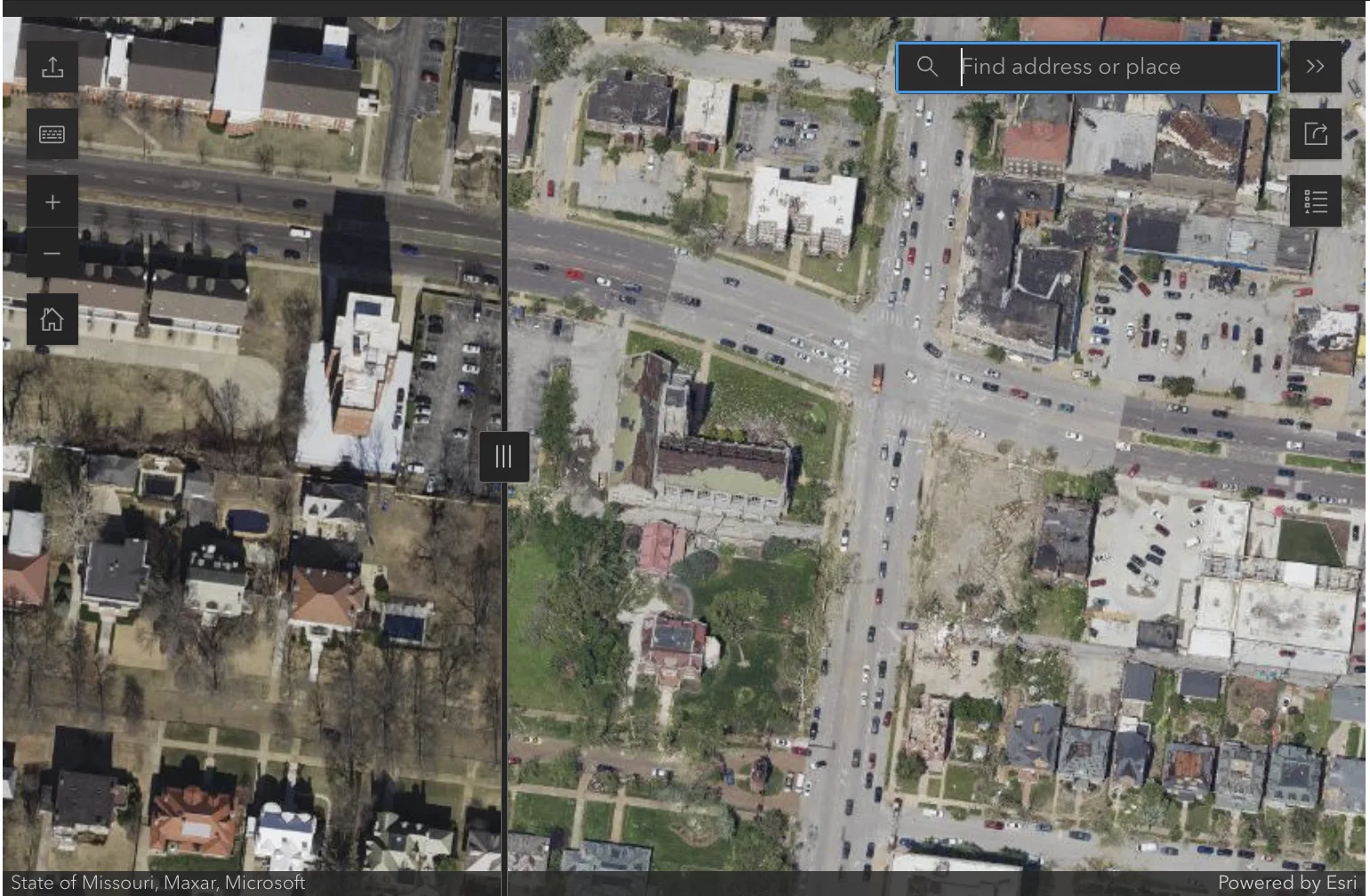
You can view how Friday’s confirmed EF-3 tornado ripped through St. Louis with this aerial map compiled by Chesterfield-based Surdex Corporation, a geospatial, mapping and data services provider.
To use it, navigate within the tool embedded just below to a specific street or search for an address with the search icon (as one example, try: Westminster Presbyterian Church at 5300 Delmar Blvd, St. Louis, MO 63112).
Get a fresh take on the day’s top news
Subscribe to the St. Louis Daily newsletter for a smart, succinct guide to local news from award-winning journalists Sarah Fenske and Ryan Krull.
Move the slider from right-to-left to compare what things looked like before the tornado and afterward. Positioning the slider all the way to the left reveals fallen trees, blown-off roofs and other damage.
Surdex executive vice president and regional manager Andy Dearing says the company flew over the region on Saturday and compiled the map pro bono for a few reasons. This kind of imagery can be a powerful and important tool for homeowners responding to damage that has occurred, especially when making insurance claims, he says. The photographic evidence clearly captures what happened and when.
Providing them to the public, free of cost, can help with the response, Dearing says. Plus, this is an area of expertise that Surdex can provide as a company local to the St. Louis region.