When quirky St. Louis-area businessman Don Robinson began acquiring parcels of Jefferson County land in the 1960s, he did so with a singular objective. Robinson wanted to own enough property to match the 843 acres found in New York’s Central Park. Throughout his life, Robinson was a simple man who dreamt big. He made and marketed a unique cleaning product called Off—and no, it was not related, or even a precursor, to the popular insect repellent that is widely used today. Robinson’s spot remover and his method of advertising it were very much his own. To help spread the word, Robinson used to buy late-night airtime on local television to broadcast the commercials in which he starred.
At his sprawling compound, Robinson lived modestly in a cottage that was built in 1928. Only one room had heat—Robinson’s upstairs bedroom. In a 2009 interview, Robinson described his living conditions as “a cut above camping.” But that’s exactly as he wanted it to be on this expansive retreat.
Discover your next outdoor adventure
Subscribe to the St. Louis Outdoors newsletter to get smarter about hiking, biking, paddling, climbing, and camping within the St. Louis region and beyond.
Robinson had no immediate family members, and as he began planning his will in the late 2000s, he decided to leave his more than 800 acres of land—as well as a trust fund to manage it—to the state. After Robinson died in 2012 at age 84, the Missouri Department of Natural Resources began a tasteful conversion of his private sanctuary, turning it into a must-see park that can be enjoyed by all.
By far, the most popular activity at this day-use park is hiking, and the two trails—Sandstone Canyon and LaBarque Hills—wind through several miles of verdant, natural beauty. Hikers, however, aren’t the only group to make regular use of the park. It’s also a popular spot for geocachers, who head to Don Robinson eager to scavenge and hunt for hidden treasure.
Camping is limited to reservations from small organizations. The Don Robinson special-use camping area is located in the southwestern corner of the park and is available to rent to groups such as the Boy Scouts, youth organizations, and other small nonprofits. The camping area can accommodate roughly 30 people.
Distance: 3.9 miles
Activities: Hiking (2 hours, 54 minutes to complete)
The first 0.6 miles of the trail is paved, making it accessible for adventurers of all ability levels. At the end of the paved portion, visitors will find a cozy shelter with multiple picnic tables where they can relax and enjoy a packed lunch before turning around. To get there, hikers will follow a path that starts in a dry dolomite woodland and features a collection of stately Chinkapin oak trees.
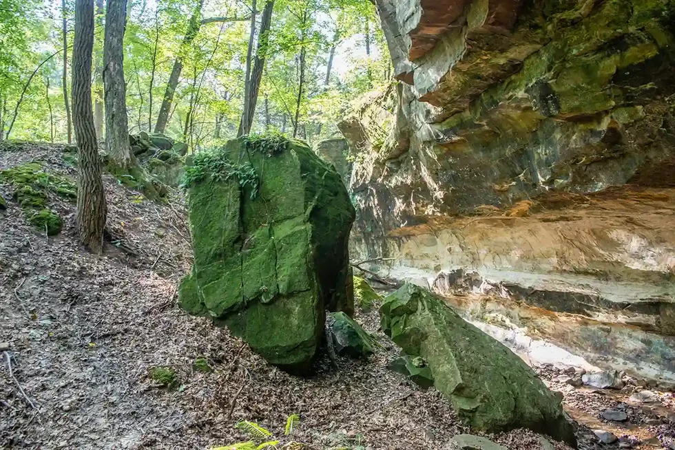
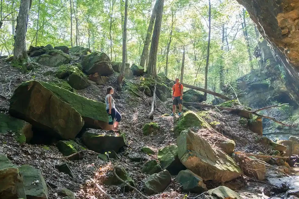
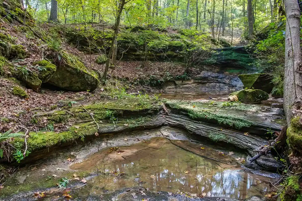
Beyond the shelter, the trail turns into a foot path that descends toward eye-catching sandstone outcroppings and canyons.
“When we laid out those trails, the ideas was for people to see what’s unique about this site,” says Erik Otto, an interpretive resource coordinator for Missouri State Parks. “We want them to see the resources that are here and why it is a state park. When people see that canyon, it’s awesome looking. It’s amazing. You see 40- to 50-foot bluffs that drop down, and there’s a stream that flows through.”
This trail also features notable elevation changes, leading hikers from 550 feet in the valley to 820 feet at the hilltops. To make the trip slightly shorter, look for the .2-mile White Connector 1 path and cut the hike in half.
Distance: 2.4 miles; loop to trailhead
Activities: Hiking (1 hour, 46 minutes to complete)
While the Sandstone Canyon Trail highlights many of the unique features of the park, including the canyons themselves, the LaBarque Hills offers a tour of the area’s geological changes. The trail takes hikers down through the sandstone woodlands before rising to a high point and opening into the dolomite woodlands. Visitors in search of memorable views flock to this trail to take in the scenery from hilltops that represent the highest points in the park.
“You’ll see a lot of sandstone outcroppings, which could be anywhere from a four-foot outcropping to some of the larger ones,” Otto says. “They get as high as 12 feet.”
The majority of the hiking trail is located within the 127-acre LaBarque Hills burn unit. As part of the park’s resource management strategy, the area was burned last March to preserve and control the natural growth. Now, hikers will see more open areas where some of the cedar trees were removed.
“It looks really, really good,” Otto says.
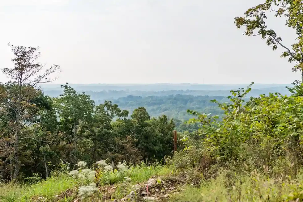
The park offers picturesque views, particularly during off-season months when the lack of foliage allows visitors to look miles into the distance. For guests who are eager to admire a sunset, the viewing platform located mere steps away from Don Robinson’s former residence at the top of the hill offers some of the most reliably awesome views of the evening sky. The platform is essentially a large, concrete patio with a covered shelter. The area includes several picnic tables and upwards of a dozen Adirondack-style rocking chairs that are great for soaking up the scene. The view overlooks the upper part of the LaBarque Creek watershed.
“The horizon is pretty low,” Otto says. “So you get a lot of sky.”
The viewing platform is also a must-visit spot for leaf peepers during the early fall. The diversity of trees found within the park present an annual show of vibrant autumnal shades of red, yellow, and orange.
“Then, once those leaves turn and drop off, your visibility is much, much greater, and you can see down into those canyons better,” Otto says. “It really is nice.”
Visiting a day or so after a substantial rainfall can add to the peaceful hiking experience. Water runs through drops and pools in various spots in the canyon. As it flows, the water makes the zen-like sounds of a babbling brook.
“People really flock out here after it rains or snows,” Otto says.
Opened: 2017
Address: 9275 Byrnesville, Cedar Hill
Coordinates: 38.388320, -90.707140
Acres: 818
Trail miles: 6.5
Roadway miles: 0.9
Camping: Yes; only available to nonprofit groups