Sinkholes have been in the news again lately, with images of exasperated homeowners interviewed by reporters standing in front of gaping holes filled with muddy water.
The city has been honest about the aging and deteriorating infrastructure of St. Louis, much of dating back to the 19th century. Factor in aging cast iron pipes and a drought that causes the dirt to shrink, and it’s a recipe for broken water mains and sewer lines.
But the history of the ground under our feet reveals that aging infrastructure isn’t the only culprit for the sinking and subsidence around St. Louis. Those looking to buy property in the city would be wise to consider the following modern and historic methods to look below the surface of potential new homes or businesses.
All good realtors in St. Louis, for example, will scoping the sewer lateral, from the house to the sewer main in the back alley. Traditionally, the sewer lateral was made of terracotta clay pipes, linked in sections of 1- to 2-foot-long pieces. As one would expect, over the course of a century, those segments of clay pipe can loosen or separate, threatening the safe passage of sewage from the house. By having a professional scope the sewer lateral before closing on the house, the buyer can be assured that costly repairs be put on the seller. (Before I purchased my house, for example, the $175 I spent to scope the sewer lateral revealed that the clay pipes required $6,500 worth of repairs, which the seller paid before closing.)
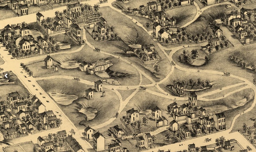
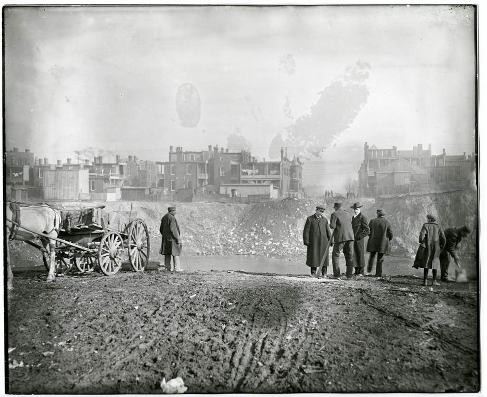
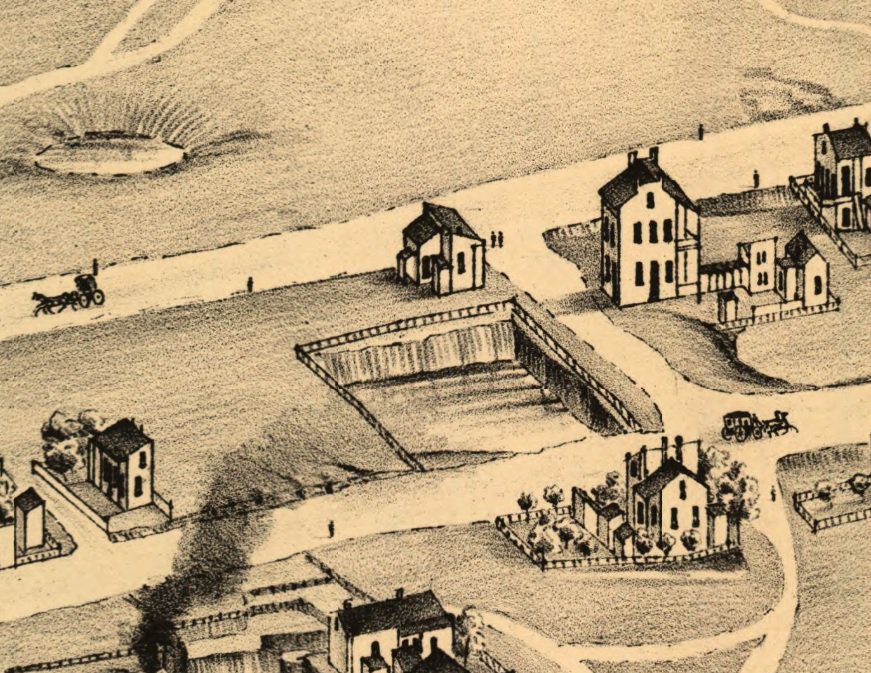
Besides using a scope, prospective buyers should consult the 1876 Compton and Dry view of St. Louis. While the city was well over a century old when the topographical survey was created, the vast majority of what is now built-up neighborhoods was still undeveloped farmland and countryside. Consequently, Compton and Dry reveals important information about why a sinkhole might be opening today. Most strikingly, what it reveals is that much of south St. Louis is built on anything but flat prairie. In fact, the city’s topography is very much the product of street grading, which smoothed the bumps and dips of the earth’s surface and replaced them with gentle inclines based on surveyors’ calculations. When it rains and puddles form in seemingly illogical places, this long-ago task is most apparent.
But street grading can’t hide the fact that much of south St. Louis is built on karst topography, which Merriam Webster’s defines as “an irregular limestone region with sinkholes, underground streams, and caverns”—in other words, a terrible place to build a city if one isn’t careful.
The United States Geological Survey offers this helpful piece of advice: “Knowing where karst features are located could help city and town planners, as well as individual landowners, to make decisions on where to build houses and other structures. This information could save cities thousands of dollars in repairs to buildings that are built on unstable karst terrain.”
If only the developers of many streets in South St. Louis had heeded such sage wisdom.
Walking around Benton Park or Benton Park West, you might come across an errant house or two leaning precariously. When there are just one or two houses sitting this way, it’s often an example of a sinkhole that was improperly filled in and has settled over time, possibly because the underground rivers that permeate the karst limestone formations are not dormant. Therefore, it’s smart for prospective buyers to consult Compton and Dry and evaluate whether their potential purchase sits atop a one-time sinkhole.
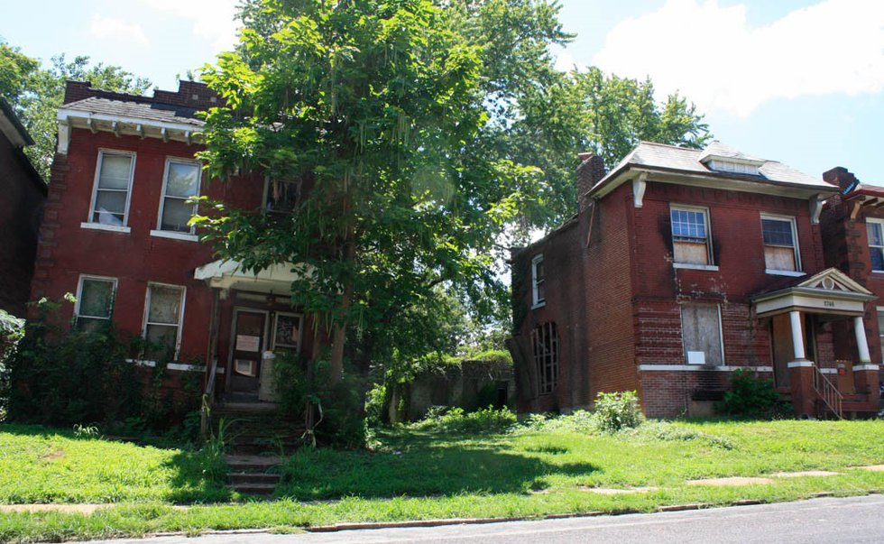
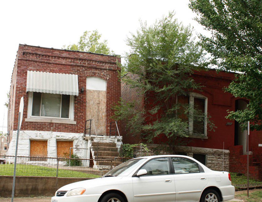
Likewise, in a similar vein, there’s the threat of former quarries, many of which probably began as sinkholes that were used as “head starts” by those seeking easy access to a limestone outcropping. Houses built on former quarries can be identified because sinking and collapsing buildings will be found in clusters. In Benton Park West, for example, there’s a group of vacant brick houses along Utah Street that, sadly, appears to be doomed.
The post-war housing crunch also caused many quarries in the city’s outer reaches to be filled in, with ranches and Cape Cod-style homes built there. Potential homeowners should be wary of buying houses in neighborhoods where there’s a strangely anachronistic group of newer houses sitting among much older architecture, particularly if the newer homes show any sign of leaning or subsidence.
Old quarry directories of St. Louis (many of which are available via Google Books) and Compton and Dry are valuable resources to consult if one is concerned about whether the land was once a quarry. Thankfully, many of these former quarries have been converted into parks, such as Handy and Windsor Parks.
As I recently wrote, there are still a few places, such as the English Cave Community Garden, where the presence of caves prevents the safe construction of houses above. In fact, since the publication of that article, I found an old building permit that revealed that a former owner of the property actually did attempt to build a small one-story house with a basement over the cave but gave up shortly after beginning excavation for the foundations.
It was a wise move, one that more St. Louisans should follow. The ground upon which St. Louis is built gives us clues about where to build—if we’re willing to listen.